Difference between revisions of "Hays County"
From Texas Century Club
Dell.Little (Talk | contribs) |
|||
| Line 1: | Line 1: | ||
==[[:Category:Region 5|Region 5 Edwards Plateau]]== | ==[[:Category:Region 5|Region 5 Edwards Plateau]]== | ||
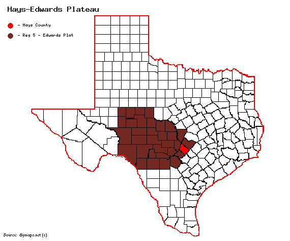
| − | '''Previous county:''' ''[[Haskell County|Haskell]]'', '''Next:''' ''[[Hemphill County|Hemphill]]''<br/ >'''Bordering counties:''' - '''Northeast:''' ''[[Travis County|Travis]]'', '''East:''' ''[[Caldwell County|Caldwell]]'', '''South:''' ''[[Guadalupe County|Guadalupe]]'', '''Southwest:''' ''[[Comal County|Comal]]'', '''West:''' ''[[Blanco County|Blanco]]''<br />[[File:Hays-red-Edwards Plateau.gif| | + | '''Previous county:''' ''[[Haskell County|Haskell]]'', '''Next:''' ''[[Hemphill County|Hemphill]]''<br/ >'''Bordering counties:''' - '''Northeast:''' ''[[Travis County|Travis]]'', '''East:''' ''[[Caldwell County|Caldwell]]'', '''South:''' ''[[Guadalupe County|Guadalupe]]'', '''Southwest:''' ''[[Comal County|Comal]]'', '''West:''' ''[[Blanco County|Blanco]]''<br />[[File:Hays-red-Edwards Plateau.gif|570px|right]] |
| + | |||
| + | == '''Century Clubbers''' == | ||
| + | {{#iDisplay:https://docs.google.com/spreadsheets/d/e/2PACX-1vTefeGdaBMZVfNdQ4Od6WNTRVm0ghvi595CsQJ5ChS8yka70SHVErS89m4E3N8eaRp9qjGH_Y8DN9PE/pubhtml?gid=0&single=true|250px}} | ||
== Top 100 == | == Top 100 == | ||
Revision as of 14:29, 25 July 2024
Contents |
Region 5 Edwards Plateau
Previous county: Haskell, Next: HemphillBordering counties: - Northeast: Travis, East: Caldwell, South: Guadalupe, Southwest: Comal, West: Blanco
Century Clubbers
Top 100
County Big Years & Big Days
Hotspots
Guides and Resources
- Great Texas Wildlife Trails - Heart of Texas East Region at Texas Parks & Wildlife
- San Marcos Loop Includes:
- Garden-Ville
- Ringtail Ridge Natural Area
- Schulle Canyon Greenspace and Trail
- Purgatory Creek Natural Area
- San Marcos River Walk
- Spring Lake Preserve Natural Area/The Meadows Center for Water and the Environment, Texas State University
- Blanco Shoals Natural Area
- Five Mile Dam Park Complex
- Lake Kyle Park
- Stagecoach Park
- John J. Stokes, Sr. Park at Thompson's Islands
- CR 266 between the San Marcos River and Staples Rd.
- San Marcos National Aquatic Resource Center
- CR 234 at Southridge Estates
- Wimberley Loop Includes:
- Red Corral Ranch
- Jacob's Well Natural Area
- Charro Ranch Park
- Blue Hole Regional Park
- Patsy Glenn Refuge
- Capitol Loop Includes:
- Dripping Springs Ranch Park
- Dell's map of Hays County for birding and exploring. It includes eBird Hotspots and additional potential locations, creek crossings and roads that may be productive.
Previous county: Haskell, Next: Hemphill
Bordering counties: - Northeast: Travis, East: Caldwell, South: Guadalupe, Southwest: Comal, West: Blanco
