Difference between revisions of "Hays County"
From Texas Century Club
Dell.Little (Talk | contribs) (→Guides and Resources) |
Dell.Little (Talk | contribs) (→Guides and Resources) |
||
| Line 25: | Line 25: | ||
:*''[http://www.theonlinezoo.com/centraltexasbirding/bicentennial_park.html Bicentennial Park]'' | :*''[http://www.theonlinezoo.com/centraltexasbirding/bicentennial_park.html Bicentennial Park]'' | ||
:*''[http://www.theonlinezoo.com/centraltexasbirding/schulle_canyon_park.html Schulle Canyon]'' | :*''[http://www.theonlinezoo.com/centraltexasbirding/schulle_canyon_park.html Schulle Canyon]'' | ||
| + | |||
| + | *'''[https://tpwd.texas.gov/huntwild/wildlife/wildlife-trails/hote Great Texas Wildlife Trails - Heart of Texas East Region]''' at Texas Parks & Wildlife | ||
| + | :*'''[https://tpwd.texas.gov/huntwild/wildlife/wildlife-trails/hote/san-marcos-loop San Marcos Loop]''' Includes: | ||
| + | ::* Garden-Ville | ||
| + | ::* Ringtail Ridge Natural Area | ||
| + | ::* Schulle Canyon Greenspace and Trail | ||
| + | ::* Purgatory Creek Natural Area | ||
| + | ::* San Marcos River Walk | ||
| + | ::* Spring Lake Preserve Natural Area/The Meadows Center for Water and the Environment, Texas State University | ||
| + | ::* Blanco Shoals Natural Area | ||
| + | ::* Five Mile Dam Park Complex | ||
| + | ::* Lake Kyle Park | ||
| + | ::* Stagecoach Park | ||
| + | ::* John J. Stokes, Sr. Park at Thompson's Islands | ||
| + | ::* CR 266 between the San Marcos River and Staples Rd. | ||
| + | ::* San Marcos National Aquatic Resource Center | ||
| + | ::* CR 234 at Southridge Estates | ||
*Dell's map of [https://drive.google.com/open?id=19Eh_h3gtvfrd962IcY2fIqhK5jGxKSml&usp=sharing| Hays County] for birding and exploring. It includes eBird Hotspots and additional potential locations, creek crossings and roads that may be productive. | *Dell's map of [https://drive.google.com/open?id=19Eh_h3gtvfrd962IcY2fIqhK5jGxKSml&usp=sharing| Hays County] for birding and exploring. It includes eBird Hotspots and additional potential locations, creek crossings and roads that may be productive. | ||
Revision as of 13:54, 10 October 2019
Contents |
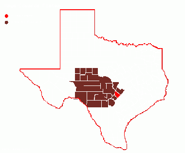
Region 5 Edwards Plateau
Previous county: Haskell, Next: HemphillBordering counties: - Northeast: Travis, East: Caldwell, South: Guadalupe, Southwest: Comal, West: Blanco
Top 100
Hotspots
Guides and Resources
- Great Texas Wildlife Trails - Heart of Texas East Region at Texas Parks & Wildlife
- San Marcos Loop Includes:
- Garden-Ville
- Ringtail Ridge Natural Area
- Schulle Canyon Greenspace and Trail
- Purgatory Creek Natural Area
- San Marcos River Walk
- Spring Lake Preserve Natural Area/The Meadows Center for Water and the Environment, Texas State University
- Blanco Shoals Natural Area
- Five Mile Dam Park Complex
- Lake Kyle Park
- Stagecoach Park
- John J. Stokes, Sr. Park at Thompson's Islands
- CR 266 between the San Marcos River and Staples Rd.
- San Marcos National Aquatic Resource Center
- CR 234 at Southridge Estates
- Dell's map of Hays County for birding and exploring. It includes eBird Hotspots and additional potential locations, creek crossings and roads that may be productive.
Top 10 Years
| Rnk | Leaders | # of Species | Year |
|---|---|---|---|
| 1 | Colton Robbins | 254 | 2018 |
| 2 | Bryan Tarbox | 251 | 2018 |
| 3 | Colton Robbins | 226 | 2015 |
| 4 | Mark Gray | 218 | 2018 |
| 5 | Bryan Tarbox | 205 | 2017 |
| 5 | Colton Robbins | 205 | 2017 |
| 5 | Colton Robbins | 205 | 2016 |
| 8 | Jeffrey Jackson | 197 | 2015 |
| 9 | Stephan Ramirez | 187 | 2011 |
| 10 | Christian Walker | 164 | 2015 |
| 10 | Byron Stone | 164 | 2002 |
Previous county: Haskell, Next: Hemphill
Bordering counties: - Northeast: Travis, East: Caldwell, South: Guadalupe, Southwest: Comal, West: Blanco
