Difference between revisions of "Franklin County"
From Texas Century Club
| Line 3: | Line 3: | ||
---- | ---- | ||
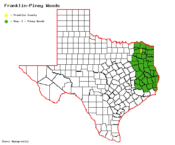
| − | [[File:Franklin-PIney Woods.gif| | + | [[File:Franklin-PIney Woods.gif|570px|right]] |
| + | |||
| + | == '''Century Clubbers''' == | ||
| + | {{#iDisplay:https://docs.google.com/spreadsheets/d/e/2PACX-1vTaPjtemp9VS_E3c1VlGQhjR5baDxosgB9B5ZmdHRYIyBfyTam9FFP7gpXITnnoO1Swq4dCHyWzbGYO/pubhtml?gid=0&single=true|250px}} | ||
== '''[http://ebird.org/ebird/top100?locInfo.regionType=subnational2&locInfo.regionCode=US-TX-159&year=AAAA&sortBy=num_species eBird Top 100]''' == | == '''[http://ebird.org/ebird/top100?locInfo.regionType=subnational2&locInfo.regionCode=US-TX-159&year=AAAA&sortBy=num_species eBird Top 100]''' == | ||
Revision as of 11:04, 10 July 2024
Contents |
Region 3 Piney Woods
Previous county: Fort Bend, Next: Freestone, All Counties: Alphabetically
Bordering counties - North: Red River, East: Titus, Southeast: Camp, South: Wood, West: Hopkins, Northeast: Delta
Century Clubbers
eBird Top 100
County Big Years & Big Days
Franklin County Top 10 Big Years
Franklin County Top 10 Big Days
Hotspots
Guides and Resources
- Great Texas Wildlife Trails - Prairies and Pineywoods East Region: Mt Vernon Loop at Texas Parks & Wildlife
- Includes:
- Inn at Selah Ranch
- Dupree Park Nature Preserve
- English Street in the City of Mt. Vernon
- Daphne Prairie
- Choctaw Trails/Bluebird Trails
- Cherokee Trace - Franklin CR NE2080
- Lake Cypress Springs
Previous county: Fort Bend, Next: Freestone
Bordering counties - North: Red River, East: Titus, Southeast: Camp, South: Wood, West: Hopkins, Northeast: Delta
