Difference between revisions of "Waller County"
From Texas Century Club
Dell.Little (Talk | contribs) (→Guides and Resources) |
Dell.Little (Talk | contribs) |
||
| (8 intermediate revisions by 2 users not shown) | |||
| Line 4: | Line 4: | ||
== Top 100 == | == Top 100 == | ||
{{#idisplay:http://ebird.org/ebird/tx/top100?locInfo.regionType=subnational2&locInfo.regionCode=US-TX-473&year=AAAA}} | {{#idisplay:http://ebird.org/ebird/tx/top100?locInfo.regionType=subnational2&locInfo.regionCode=US-TX-473&year=AAAA}} | ||
| + | ---- | ||
| + | |||
| + | == County Big Years & Big Days == | ||
| + | |||
| + | <span style="font-size:120%">'''[[County_Big_Years#Waller_County_-_Coastal_Prairie|Waller County Top 10 Big <span style="font-size:130%">Years]]''' | ||
| + | |||
| + | <span style="font-size:120%">'''[[County_Big_Days#Waller_County_-_Coastal_Prairie|Waller County Top 10 Big <span style="font-size:130%">Days]]''' | ||
---- | ---- | ||
| Line 11: | Line 18: | ||
== Guides and Resources == | == Guides and Resources == | ||
| − | *'''[https://tpwd.texas.gov/huntwild/wildlife/wildlife-trails/utc/katy-prairie-loop Great Texas | + | *'''[https://tpwd.texas.gov/huntwild/wildlife/wildlife-trails/utc/katy-prairie-loop Great Texas Coastal Birding Trail - Upper Texas Coast Region: Katy Prairie Loop]''' at Texas Parks & Wildlife |
| − | :Includes: | + | :Includes: Buller and Harper's Church Roads |
| − | + | ||
*Dell's map of [https://drive.google.com/open?id=1RD9jHpym-wvUEQGvIqN_lMzIzFc&usp=sharing| Waller County] for birding and exploring. Since Waller County is well represented with eBird Hotspots, there are no other locations. | *Dell's map of [https://drive.google.com/open?id=1RD9jHpym-wvUEQGvIqN_lMzIzFc&usp=sharing| Waller County] for birding and exploring. Since Waller County is well represented with eBird Hotspots, there are no other locations. | ||
| − | |||
| − | |||
| − | |||
| − | |||
| − | |||
| − | |||
| − | |||
| − | |||
| − | |||
| − | |||
| − | |||
| − | |||
| − | |||
| − | |||
| − | |||
| − | |||
| − | |||
| − | |||
| − | |||
| − | |||
| − | |||
| − | |||
| − | |||
| − | |||
| − | |||
---- | ---- | ||
'''Previous county:''' ''[[Walker County|Walker]]'', '''Next:''' ''[[Ward County|Ward]]''<br />'''Bordering counties''' - '''North:''' ''[[Grimes County|Grimes]]'', '''Northeast:''' ''[[Montgomery County|Montgomery]]'', '''East:''' ''[[Harris County|Harris]]'', '''South:''' ''[[Fort Bend County|Fort Bend]]'', '''West:''' ''[[Austin County|Austin]]'', '''Northwest:''' ''[[Washington County|Washington]]'' | '''Previous county:''' ''[[Walker County|Walker]]'', '''Next:''' ''[[Ward County|Ward]]''<br />'''Bordering counties''' - '''North:''' ''[[Grimes County|Grimes]]'', '''Northeast:''' ''[[Montgomery County|Montgomery]]'', '''East:''' ''[[Harris County|Harris]]'', '''South:''' ''[[Fort Bend County|Fort Bend]]'', '''West:''' ''[[Austin County|Austin]]'', '''Northwest:''' ''[[Washington County|Washington]]'' | ||
Latest revision as of 18:39, 15 December 2020
Contents |
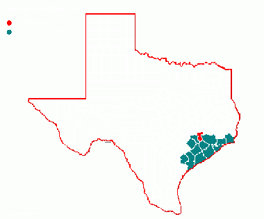
Region 8 Coastal Prairie
Previous county: Walker, Next: WardBordering counties - North: Grimes, Northeast: Montgomery, East: Harris, South: Fort Bend, West: Austin, Northwest: Washington
Top 100
County Big Years & Big Days
Waller County Top 10 Big Years
Hotspots
Guides and Resources
- Great Texas Coastal Birding Trail - Upper Texas Coast Region: Katy Prairie Loop at Texas Parks & Wildlife
- Includes: Buller and Harper's Church Roads
- Dell's map of Waller County for birding and exploring. Since Waller County is well represented with eBird Hotspots, there are no other locations.
Previous county: Walker, Next: Ward
Bordering counties - North: Grimes, Northeast: Montgomery, East: Harris, South: Fort Bend, West: Austin, Northwest: Washington
