Difference between revisions of "Presidio County"
From Texas Century Club
Dell.Little (Talk | contribs) |
Dell.Little (Talk | contribs) |
||
| (21 intermediate revisions by one user not shown) | |||
| Line 1: | Line 1: | ||
| − | =[[:Category:Region 4|Region 4 Trans-Pecos]]= | + | ==[[:Category:Region 4|Region 4 Trans-Pecos]]== |
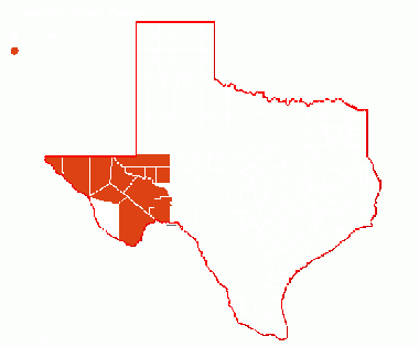
| + | '''Previous county:''' ''[[Potter County|Potter]]''; '''Next:''' ''[[Rains County|Rains]]''<br />'''Bordering counties''' - '''North:''' ''[[Jeff Davis County|Jeff Davis]]'', '''East:''' ''[[Brewster County|Brewster]]''<br />[[File:Presidio-Trans Pecos.gif|380px|left]] | ||
| + | |||
| + | == Top 100 == | ||
{{#iDisplay:http://ebird.org/ebird/top100?locInfo.regionType=subnational2&locInfo.regionCode=US-TX-377&year=AAAA}} | {{#iDisplay:http://ebird.org/ebird/top100?locInfo.regionType=subnational2&locInfo.regionCode=US-TX-377&year=AAAA}} | ||
| + | ---- | ||
| + | |||
| + | == County Big Years & Big Days== | ||
| + | |||
| + | <span style="font-size:120%">'''[[County_Big_Years#Presidio_County_-_Trans-Pecos|Presidio County Top 10 Big <span style="font-size:130%">Years]]''' | ||
| + | |||
| + | <span style="font-size:120%">'''[[County_Big_Days#Presidio_County_-_Trans-Pecos|Presidio County Top 10 Big <span style="font-size:130%">Days]]''' | ||
| + | ---- | ||
| + | |||
| + | ==Hotspots== | ||
| + | {{#idisplay:https://ebird.org/region/US-TX-377/hotspots?yr=all&m=}} | ||
| + | ---- | ||
| + | |||
| + | == Guides and Resources == | ||
| + | *'''[https://tpwd.texas.gov/huntwild/wildlife/wildlife-trails/fwtx Great Texas Wildlife Trails - Far West Texas Region]''' at Texas Parks & Wildlife | ||
| + | :*'''[https://tpwd.texas.gov/huntwild/wildlife/wildlife-trails/fwtx/big-bend-loop Big Bend Loop]''' Includes: | ||
| + | ::*Big Bend Ranch SP (Interior) | ||
| + | ::*Rancherias Canyon Trail and Colorado Canyon River Access (Big Bend Ranch SP) | ||
| + | ::*Closed Canyon (Big Bend Ranch SP) | ||
| + | ::*Madera Canyon and Grassy Banks Campground (Big Bend Ranch SP) | ||
| + | :*'''[https://tpwd.texas.gov/huntwild/wildlife/wildlife-trails/fwtx/upper-rio-grande-loop Upper Rio Grande Loop]''' Includes: | ||
| + | ::*Chinati Hot Springs | ||
| + | ::*Loma Paloma Golf Course and RV Park (BJ Bishop Wetlands) | ||
| + | ::*Fort Leaton State Historic Site | ||
| + | :*'''[https://tpwd.texas.gov/huntwild/wildlife/wildlife-trails/fwtx/davis-mountains-loop Davis Mountains Loop]''' Includes: | ||
| + | ::*Sunset Park (Marfa) | ||
| + | |||
| + | *Dell's map of [https://drive.google.com/open?id=17kbRWtxDOf3fMXXdRvCAroL6z2l_KNzv&usp=sharing| Presidio County] including eBird Hotspots, plus other potential locations such as ponds, water crossings and obscure roads | ||
| + | |||
| + | ---- | ||
| + | '''Previous county:''' ''[[Potter County|Potter]]''; '''Next:''' ''[[Rains County|Rains]]''<br />'''Bordering counties''' - '''North:''' ''[[Jeff Davis County|Jeff Davis]]'', '''East:''' ''[[Brewster County|Brewster]]'' | ||
[[Category:Region 4]] | [[Category:Region 4]] | ||
[[Category:All Counties]] | [[Category:All Counties]] | ||
Latest revision as of 17:19, 14 December 2020
Contents |
Region 4 Trans-Pecos
Previous county: Potter; Next: RainsBordering counties - North: Jeff Davis, East: Brewster
Top 100
County Big Years & Big Days
Presidio County Top 10 Big Years
Presidio County Top 10 Big Days
Hotspots
Guides and Resources
- Great Texas Wildlife Trails - Far West Texas Region at Texas Parks & Wildlife
- Big Bend Loop Includes:
- Big Bend Ranch SP (Interior)
- Rancherias Canyon Trail and Colorado Canyon River Access (Big Bend Ranch SP)
- Closed Canyon (Big Bend Ranch SP)
- Madera Canyon and Grassy Banks Campground (Big Bend Ranch SP)
- Upper Rio Grande Loop Includes:
- Chinati Hot Springs
- Loma Paloma Golf Course and RV Park (BJ Bishop Wetlands)
- Fort Leaton State Historic Site
- Davis Mountains Loop Includes:
- Sunset Park (Marfa)
- Dell's map of Presidio County including eBird Hotspots, plus other potential locations such as ponds, water crossings and obscure roads
Previous county: Potter; Next: Rains
Bordering counties - North: Jeff Davis, East: Brewster
